I’ve been using this book for a while……it’s compact and readable, and mostly right. However……
This weekend I became aware that it really isn’t much more than a starting place, sometimes. A fair amount of guesswork and luck is necessary in order to use this book successfully. Now, maybe that is the essence of lighthouse hunting. Certainly the thrill of the hunt is a part of it lol. But really……does it have to be so hard???
Also, this book is at times just dead WRONG and that is unacceptable.
Sooooo………
I’m going to put what would be MY corrections and additions to this book as I go along. 🙂
The Lights of Lake Ontario
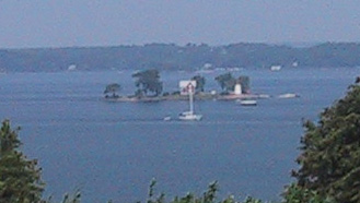
19 Crossover Island
Established: (1848)1882
Status: Inactive; privately owned
Location: (NY) 4 miles NE of Chippewa Bay
Type: Conical. cast iron
Access: Boat
About the Light: Crossover Island takes its name from the fact that this was where ships crossed from the U.S. to the Canadian side of the channel. Completely rebuilt in 1882, it replaces the original 1848 light that consisted of a dwelling with the tower attached. The light is visible from the scenic overlook on Route 12 east of Chippewa Bay.
[edit] Ummm, really? There are better places to see it from, at any rate! (not even sure which scenic overlook they are referring to – there are two of them!) This is how *I* would go to see the lighthouse (without a boat):
Take Route 12 east from Chippewa Bay. Just after Conger Rd. (on your right), turn left onto River Ledge Rd. Go either right or left on River Ledge and look for Crossover Island through the gaps in the trees. 🙂
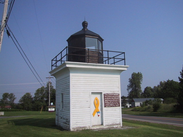
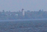
20 Ogdensburgh Harbor
Established: (1834) 1900
Status: Inactive; private residence
Location: (NY) On the tip of Lighthouse Point which makes up the mouth of the Oswegatchie River.
Type: Square/integral limestone tower and dwelling
Access: Boat; private property, not visible from the road
About the light: Very similar in design to the lights at Stony Point and Horse Island, this light stands 65 feet high. It was built on the site of an old fort which was used to fend off local Indians by the French as they gained a foothold in the area. Later, the site was also used for a “pest house” for cholera victims.
[edit] What are you talking about? It’s totally visible!!
Not from the road, no – go across the bridge to the marina on the other side and look across!! It’s right there! There is even a free set of binoculars on the pier so that you can get a really good view! 🙂 (As a bonus, you can also see Windmill Point, the Prescott Visitors’ Center and the Prescott Breakwater Light across the harbour.)
The marina is located in Prescott Park at the end of Catherine St.
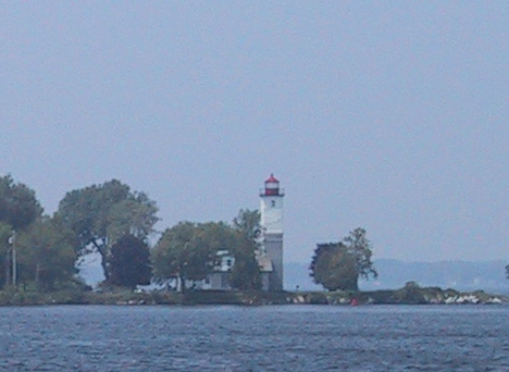
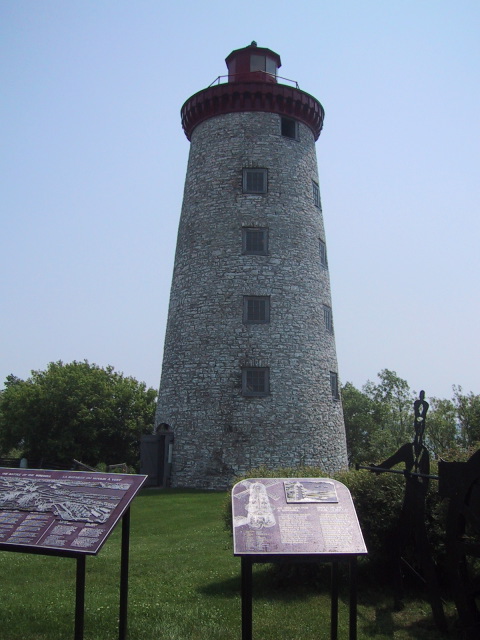
21 Windmill Point
Established: 1873
Status: Inactive
Location: (ONT) On St. Lawrence River 1.3 miles east of Prescott on Hwy 2 (King Street)
Type: Conical stone tower
Access: Car
About the Light: Originally built as a windmill in the 1920s, the tower was converted into a lighthouse in 1873 and deactivated in 1978. In 1838, the Battle of the Windmill took place here. During the Patriot War, a group of Americans and Canadian rebels launched an attack from Ogdensburg hoping to wrest control of nearby Fort Wellington from the British. The Americans took refuge in the windmill, from which they defied the besiegers for several days until guns brought down from Kingston forced their surrender.
[edit] I don’t have any major beef with this entry…it was pretty much correct. I would just add some more detail that the book doesn’t mention……..
You can go inside! And climb up!! How cool is that? 😀
It is maintained as a historical battlesite (so look for signs for The Battle of the Windmill), but part of that is the ability to climb up inside, almost all the way up to the light! 🙂
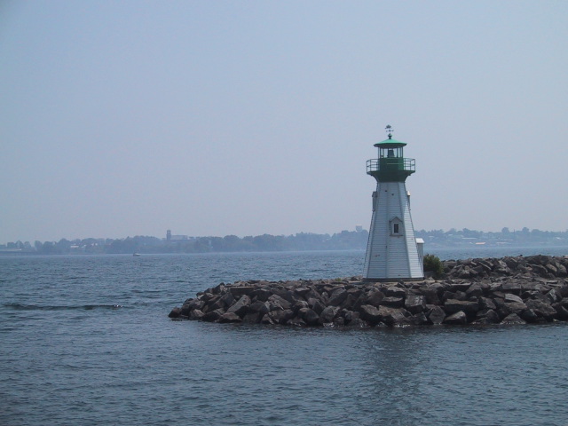
22 Prescott Breakwater
Established:
Status: Active
Location: (ONT) End of rocky pier separating city marina from St. Lawrence River
Type: Short octogonal wooden tower
Access: Boat
About the Light: Also known as Prescott Harbor Outer Light, this 20-foot tower rises to support a bright green lantern and parapet and functions as an entry light for the city marina.
[edit] “Access by boat”……….what kind of access do you want?? You can get pretty darn close! – good enough for me! Totally visible from the marina – you are within 20 feet. What? Do want to pet it or something? 😛
It’s a very cute little lighthouse. But that’s about it. I was satisfied.
Note: The intrepid explorer who really wants to get up close and personal with this lighthouse probably can. You have to climb on the pointy rocks to do it, but it’s do-able. Likely frowned upon, but not explicitly forbidden. FYI.
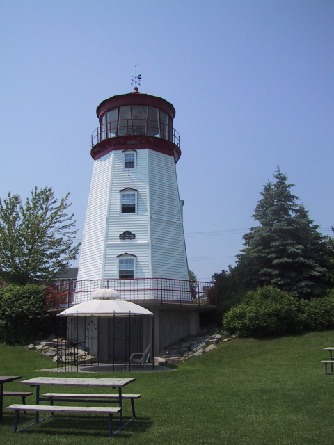
23 Prescott Visitors’ Center
Established:
Status: Private aid to navigation
Location: (ONT) Overlooks Prescott city marina
Type: Octogonal wooden tower
Access: Car
About the Light: This is a 40-foot-high modern replica with a Fresnel lens donated by the Canadian Coast Guard.
[edit] Calling it a replica is mis-information, in my opinion. That makes it sound like it’s a replica of something…….some particular lighthouse that either stood on that spot, or nearby – which it’s not. It’s a replica of a “generic lighthouse,” that’s what the information at the site said.
Instead, I would call it a lighthouse simulacrum. A much better term for it.
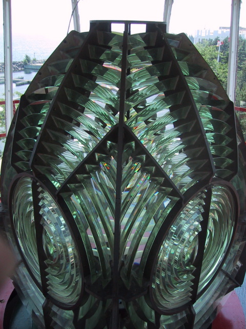
If you take it for what it is, it’s amazing! You can climb all the way up to the top of the light and look out over the harbour. 🙂 Best of all, you can get down and dirty with the honkin’ big Fresnel lens in it. That thing is HUGE!! 😮
When you come back down you can get ice cream. 😀
 More photos are available on